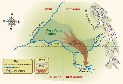
Pueblo I Map
For most of the Pueblo I period, the climate was good for growing corn. So the population in the Mesa Verde region grew.
But at the end of the Pueblo I period, there was a drought in the Mesa Verde region. The hot, dry weather made it difficult to grow enough corn to feed all the people. So, most people left the Mesa Verde region.

Late in the Pueblo I period, most Pueblo people moved south. Where did they go? In their oral histories, Pueblo Indians tell us that their ancestors moved south. Archaeologists have found evidence that supports the oral histories. They think many Pueblo people moved from the Mesa Verde region to a place called Chaco Canyon. Chaco Canyon is located in New Mexico, about 120 miles (193 kilometers) south of the middle of the Mesa Verde region. Throughout the following period, Chaco was an important cultural center for the Pueblo people. |
|
 DONATE TODAY
