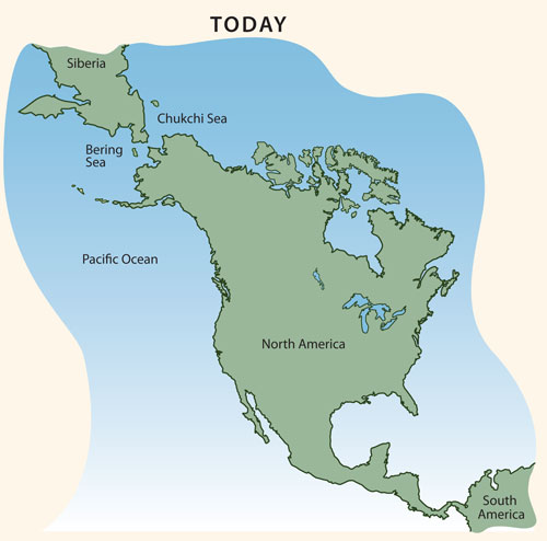
Paleoindian Map

This is what the area between Siberia and North America looks like today. Before the Paleoindian period, no humans lived in North or South America. So how did people first come to the Americas? Archaeologists think the first Americans probably crossed from Siberia into North America. Some people may have walked across the Bering Land Bridge. The Bering Land Bridge was a wide strip of land that connected Siberia and North America during the Ice Age. Move your mouse over the map to see the Bering Land Bridge. The land bridge disappeared underwater when the glaciers melted at the end of the Ice Age. It is also possible that people came to the Americas by following the Pacific coast. They might have walked along the coast or traveled in boats. Move your mouse over the map to see the coastal route. Regardless of how people came, once they arrived, they quickly spread out in all directions. |
 DONATE TODAY
